Explore the Alabama County Map and view all 67 counties at a glance. Find county names, boundaries, major cities, county seats, population data, and detailed geographic information for Alabama.
All Alabama Counties: Names, Map & County Information
Explore all 67 counties in Alabama with a detailed county list, map, county seats, and key information. Find every Alabama county in one place.h here
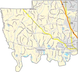
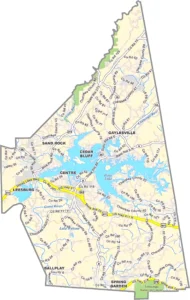
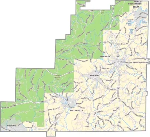
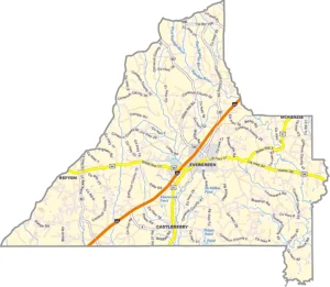
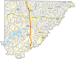
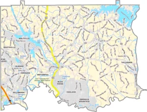
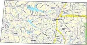
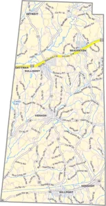
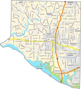
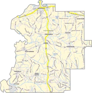
Autauga County Alabama GIS Map
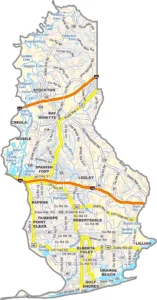
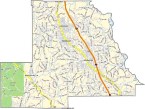
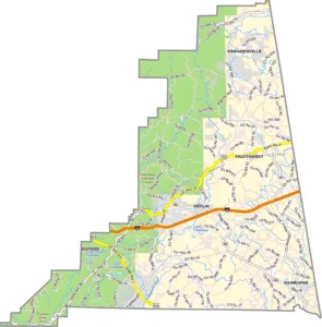
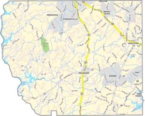
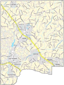
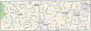
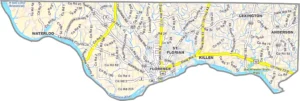
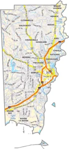
Baldwin County Alabama GIS Map
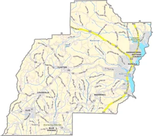
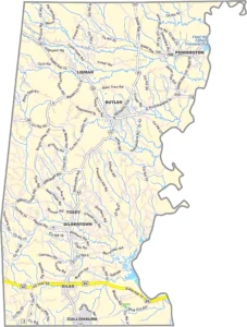
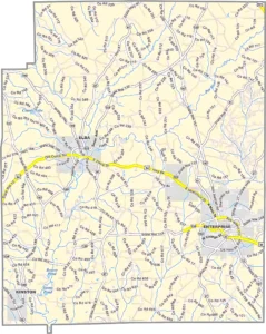
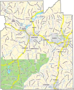
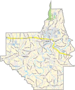
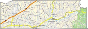
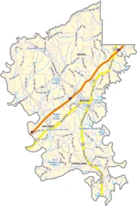
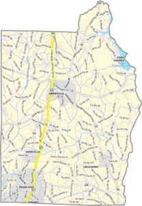
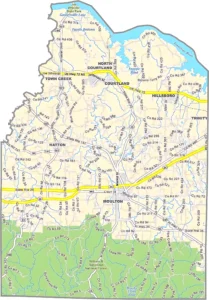
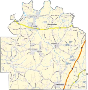
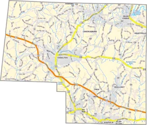
Barbour County Alabama GIS Map
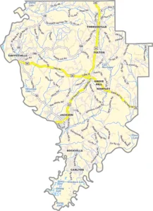
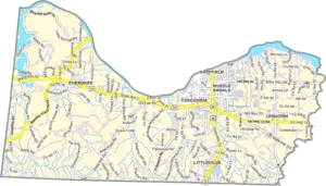
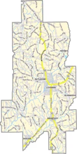
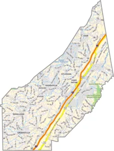
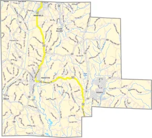
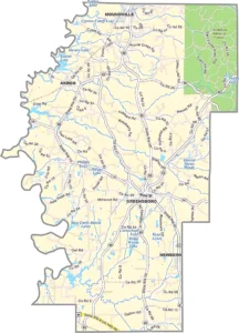
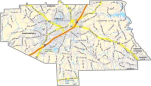
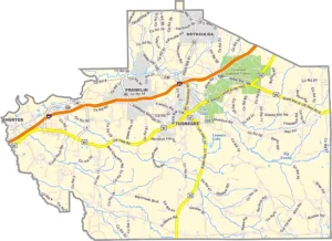
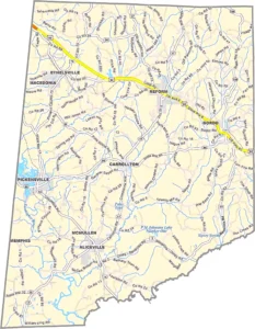
Bibb County Alabama GIS Map
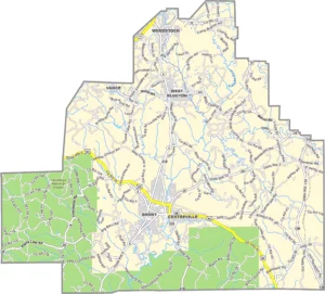
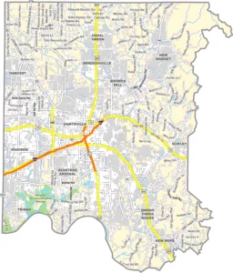
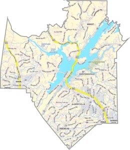
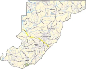
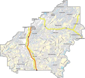
Blount County Alabama GIS Map
Bullock County Alabama GIS Map
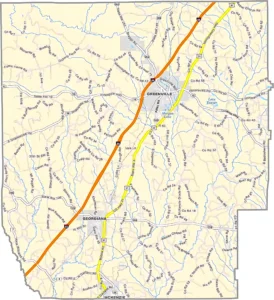
Butler County Alabama GIS Map
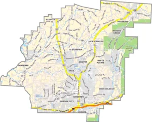
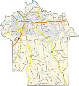
Calhoun County Alabama GIS Map
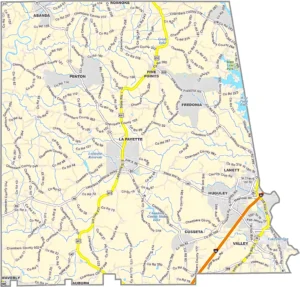
Chambers County Alabama GIS Map
Cherokee County Alabama GIS Map
Chilton County Alabama GIS Map
Choctaw County Alabama GIS Map
Clarke County Alabama GIS Map
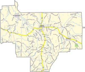
Clay County Alabama GIS Map
Cleburne County Alabama GIS Map
Coffee County Alabama GIS Map
Colbert County Alabama GIS Map
Conecuh County Alabama GIS Map
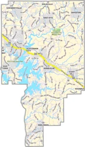
Coosa County Alabama GIS Map
Covington County Alabama GIS Map
Crenshaw County Alabama GIS Map
Cullman County Alabama GIS Map
Dale County Alabama GIS Map
Dallas County Alabama GIS Map
DeKalb County Alabama GIS Map
Elmore County Alabama GIS Map
Escambia County Alabama GIS Map
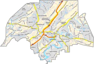
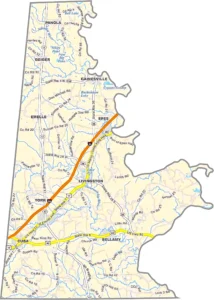
Etowah County Alabama GIS Map
Fayette County Alabama GIS Map
Franklin County Alabama GIS Map
Geneva County Alabama GIS Map
Greene County Alabama GIS Map
Hale County Alabama GIS Map
Henry County Alabama GIS Map
Houston County Alabama GIS Map
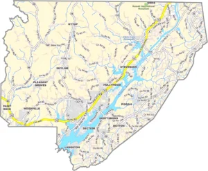
Jackson County Alabama GIS Map
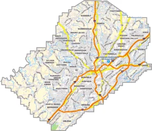
Jefferson County Alabama GIS Map
Lamar County Alabama GIS Map
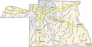
Lauderdale County Alabama GIS Map
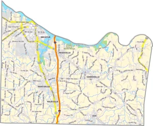
Lawrence County Alabama GIS Map
Lee County Alabama GIS Map
Limestone County Alabama GIS Map
Lowndes County Alabama GIS Map
Macon County Alabama GIS Map
Madison County Alabama GIS Map
Marengo County Alabama GIS Map
Marion County Alabama GIS Map
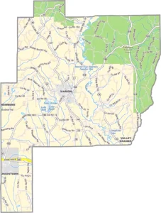
Marshall County Alabama GIS Map
Mobile County Alabama GIS Map
Monroe County Alabama GIS Map
Montgomery County Alabama GIS Map
Morgan County Alabama GIS Map
Perry County Alabama GIS Map
Pickens County Alabama GIS Map
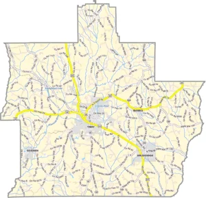
Pike County Alabama GIS Map
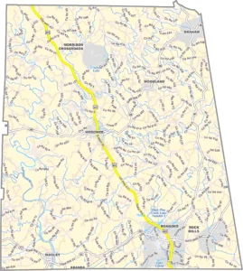
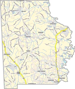
Randolph County Alabama GIS Map
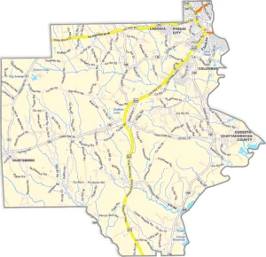
Russell County Alabama GIS Map
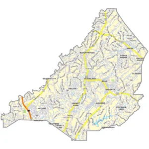
Shelby County Alabama GIS Map
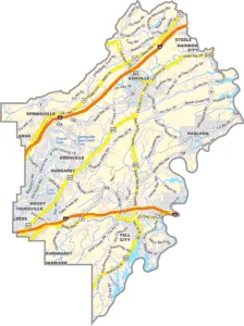
St. Clair County Alabama GIS Map
Sumter County Alabama GIS Map
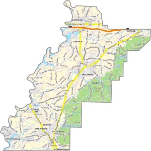
Talladega County Alabama GIS Map
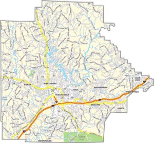
Tallapoosa County Alabama GIS Map
Tuscaloosa County Alabama GIS Map
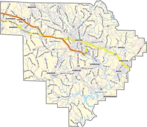
Walker County Alabama GIS Map
Washington County Alabama GIS Map
Wilcox County Alabama GIS Map
Winston County Alabama GIS Map
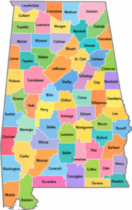
Alabama County Map Overview
The Alabama County Map is an essential resource for understanding the geographic and administrative divisions of Alabama. Located in the southeastern United States, Alabama is divided into 67 counties, each serving as a local government unit responsible for public services, property records, law enforcement, elections, and community development.Whether you are researching Alabama geography, planning a trip, studying demographics, or working on GIS mapping projects, an Alabama County Map provides valuable insights into the state's structure and regional characteristics.
Alabama at a Glance
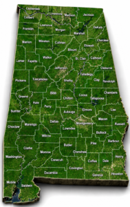
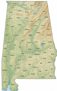
What Does Alabama Include?
Alabama offers a diverse landscape featuring mountains, rivers, forests, lakes, coastal areas, and vibrant cities.
Interesting Facts About Alabama Counties
Conclusion
The Alabama County Map provides a clear view of all 67 counties and helps users understand the state's geography, population distribution, transportation networks, and administrative divisions. Whether you are a traveler, student, researcher, GIS professional, or resident, an Alabama county map is an excellent tool for exploring everything Alabama has to offer.
